SERVICES
PRIVATE
INDIVIDUALS, HOMEOWNERS, HUNTERS, EVENT PLANNERS, LANDOWNERS, AND MORE
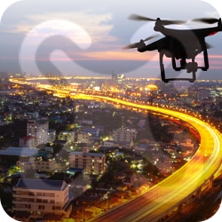
AERIAL PHOTOS
Drone photography offers a unique and captivating perspective that simply can't be achieved with traditional photography methods. Drones can capture stunning aerial shots of landscapes, architecture, events, and more, providing a bird's eye view that adds depth and dimension to any photograph. With advancements in drone technology, high-quality images and videos are more accessible and affordable than ever before. Drone photography can be a valuable tool for businesses and individuals looking to stand out on social media, promote their brand, or showcase a property.
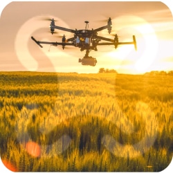
HUNTING MAPS
Drone mapping technology has revolutionized the way hunters approach their craft. With the ability to create detailed maps of hunting areas, drones can help hunters identify game trails, water sources, and potential obstacles. This information can be used to plan more effective hunting routes and make better decisions when tracking game. Additionally, drone mapping can be used to identify areas that may have been previously overlooked, giving hunters a strategic advantage.

EVENT VIDEO & PHOTOGRAPHY
Drone video and photography add an exciting and unique element to any event. Drones can capture stunning aerial shots that provide a new perspective and create a memorable experience for guests. Whether it's a wedding, concert, festival, or corporate event, drones can capture the energy and atmosphere of the occasion like no other camera can. The footage can be used to promote future events, create engaging content for social media, or simply as a way to preserve the memories of the day.
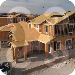
PROPOSED HOME SITE MAPPING
Looking to sell your home or need to plan for a new home? Consider using our cutting-edge drone technology to create an immersive and detailed mapping experience of your property. Our drones capture stunning aerial footage that showcase the full beauty of your home and surrounding neighborhood. The detailed mapping of your property allows you to explore and envision yourself living in your home without ever stepping foot inside.
COMMERCIAL
ENGINEERING, SURVEYING, CONSTRUCTION, EXCAVATING, REAL ESTATE, ROOFING, DEVELOPMENT, GOLF COURSES & MORE
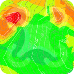
TOPOGRAPHIC MAPPING
Topographic mapping using drones is a revolutionary and cost-effective way to capture accurate and detailed data about the Earth's surface. With high-resolution cameras and GPS technology, drones can quickly and efficiently collect data that would have previously taken teams of people weeks or months to map. This data can then be used to create detailed topographic maps that can aid in a wide range of industries, from construction and engineering to land management and environmental monitoring.

ALTA SURVEYING & OTHER SURVEY ASSISTANCE
Using drones for surveying is a game-changer for the surveying industry. With their ability to quickly and accurately capture data over large areas, drones can significantly reduce surveying time and costs while improving accuracy and data quality. This makes them an ideal tool for a wide range of surveying applications, from construction and land development to environmental monitoring and disaster response. Drone surveying also increases safety by eliminating the need for surveyors to work in hazardous areas, such as high elevations or steep terrain.

PRE-CONSTRUCTION
Drone services can provide a wealth of benefits to pre-construction projects. By utilizing drones, construction project managers can obtain high-quality aerial imagery and mapping data that can be used to create detailed and accurate 3D models of the project site. This data can then be used to improve project planning, assess site access, evaluate environmental impact, and ensure compliance with regulations. Drone services can also be used to monitor construction progress, identify potential issues, and enhance safety by providing a bird's-eye view of the construction site.
UTILITY LOCATES
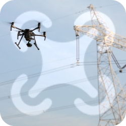
Drone services can be a game-changer for utility marking. By utilizing drones, utility companies can quickly and accurately map utility lines, pipelines, and other infrastructure. Drones can provide high-resolution imagery and thermal imaging, making it easier to identify potential problems, such as leaks or damage, in a timely manner. This data can then be used to make informed decisions on maintenance, repairs, and upgrades. By using drone services, utility companies can improve safety by minimizing the need for workers to enter hazardous areas and reduce costs associated with traditional surveying methods.

GOLF COURSE SERVICES
Golf courses drone videos offer a new and unique perspective that traditional filming methods cannot capture. With high-quality cameras and smooth aerial movements, drones can provide stunning footage that showcases the beauty and layout of golf courses. Golf course drone videos can be used to market and promote the course, as well as to help players familiarize themselves with the course layout and design. The videos can also be used to create engaging content for social media and websites, helping to attract new players and increase revenue. Overall, golf course drone videos provide an innovative and captivating way to showcase a golf course.
ROOF INSPECTIONS
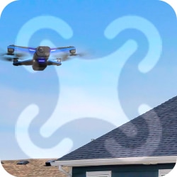
Drone services offer a cost-effective and efficient solution for roof inspections. By utilizing drones, roofing professionals can capture high-resolution images and videos of a roof's condition without the need for scaffolding or ladders, making it safer and more time-efficient. Drones can also provide thermal imaging capabilities, making it easier to identify potential issues, such as leaks or areas with poor insulation. This data can then be used to create detailed reports that provide actionable insights into the roof's condition, which can help to improve maintenance and repair planning.
REAL ESTATE
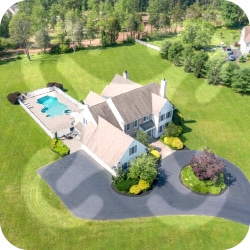
Our services offer an innovative and engaging way to showcase real estate properties. By utilizing drones, real estate agents and property managers can capture high-quality aerial images and videos that showcase the property's unique features and location. Drones can provide a bird's-eye view of the property, highlighting key selling points such as scenic views, landscaping, and outdoor amenities. This data can then be used to create immersive virtual tours, interactive maps, and compelling marketing materials that can help properties stand out in a competitive market.
INFRASTRUCTURE INSPECTIONS
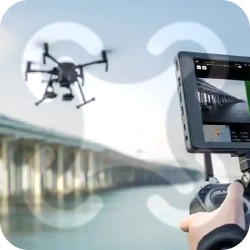
Our flight services revolutionize infrastructure inspections by providing a faster, safer, and more cost-effective way to assess the condition of critical infrastructure such as bridges, dams, power lines, and pipelines. By utilizing drones, infrastructure professionals can capture high-resolution images and videos of the infrastructure, making it easier to identify potential problems, such as cracks or corrosion. Drones equipped with thermal imaging can also help detect hotspots or areas with inadequate insulation. This data can then be used to create detailed reports that provide actionable insights into the infrastructure's condition, which can help improve maintenance planning and prevent costly repairs. By using drone services, infrastructure professionals can save time and money, reduce safety risks associated with traditional inspection methods, and enhance the quality of their work.
GOVERNMENT
CITY, COUNTY, STATE, FEDERAL AGENCIES. INCLUDING THE FORESTRY AGENCIES
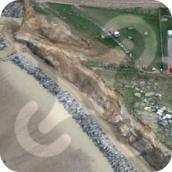
EROSION CONTROL
We provide a powerful tool for erosion control by enabling quick and accurate monitoring of soil erosion patterns over large areas. By utilizing drones, erosion control professionals can capture high-resolution images and videos that identify areas of erosion and highlight soil movement patterns. This data can then be used to create detailed maps and models that can inform erosion control strategies, including vegetation planting, terracing, or diversion of runoff water. Drones can also provide thermal imaging that can detect areas of high soil moisture that may be prone to further erosion.
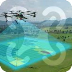
AREA & VOLUME MEASUREMENTS
UAV Aerial photography can provide a fast and accurate solution for area measurement across large and complex sites. By utilizing drones, land surveyors and other professionals can capture high-resolution images and generate detailed maps that measure areas of interest, including agricultural fields, forests, and construction sites. Drones equipped with Light Detection and Ranging (LiDAR) technology can provide highly accurate 3D models, which can inform topographic mapping, volume calculations, and building site planning.

PROJECT PROGRESS
Drone services are an excellent tool for monitoring project progress, offering a cost-effective and efficient way to capture high-quality images and video footage of construction sites, mining operations, and other industrial projects. With our drone services, you can get an accurate and up-to-date view of your project site from a unique perspective, allowing you to make informed decisions and adjustments to your project plan. Our drone pilots are trained and certified professionals, capable of safely navigating complex environments and capturing the data you need to manage your project more effectively.

FORESTRY MAPPING
Drones have revolutionized the way forestry mapping is done, providing accurate and detailed information about forested areas that was previously impossible to gather. Our drone services offer the latest technology in forestry mapping, providing high-resolution images and 3D models of the forest canopy, which can help forestry managers and landowners make informed decisions about forest management and conservation. Our professional and experienced drone pilots can quickly and safely survey large areas of forest, providing accurate data that can be used for a wide range of applications, from estimating timber volumes to identifying areas of potential erosion and forest fire risks. With our drone services, you can save time and money, while also ensuring that your forestry management practices are efficient and sustainable.
AGRICULTRAL
FARMERS
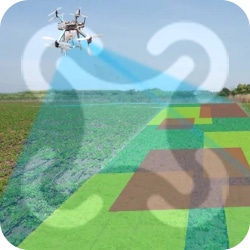
CROP HEALTH
Drone services for crop health can provide valuable insights for farmers to optimize their yields and minimize their expenses. By using high-resolution aerial imagery, drones can detect early signs of plant stress, disease, or nutrient deficiencies, which can be difficult to spot from the ground. This allows farmers to take action before the problem becomes severe, resulting in healthier crops and higher yields. In addition, drone services can help farmers to precisely apply fertilizers, pesticides, and herbicides, reducing the amount of chemicals needed and minimizing environmental impact.
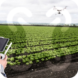
HERBICIDE & PESTICIDE TREATMENTS
Drone herbicide and pesticide treatment can provide an efficient and effective solution for crop management. By using drones equipped with advanced sensors and spraying equipment, farmers can precisely target and treat specific areas of their fields, reducing waste and increasing the accuracy of their application. This can also help to minimize exposure to potentially harmful chemicals for workers and surrounding communities. In addition, drones can cover large areas quickly, allowing farmers to treat their crops in a timely and cost-effective manner.

VARIABLE RATE TREATMENT MAPPING
Variable rate treatment can provide farmers with a powerful tool to optimize their crop yields and minimize their expenses. By using drones equipped with sophisticated sensors, farmers can collect precise data about their fields, such as soil moisture, nutrient levels, and plant health. This data can then be analyzed and used to generate customized treatment plans for specific areas of the field, optimizing the amount and type of fertilizer, pesticide or herbicide required in each location. This can lead to higher yields, reduced input costs, and less environmental impact. Additionally, variable rate treatment allows farmers to more efficiently target specific areas of their fields, minimizing the amount of chemicals applied in non-target areas.

